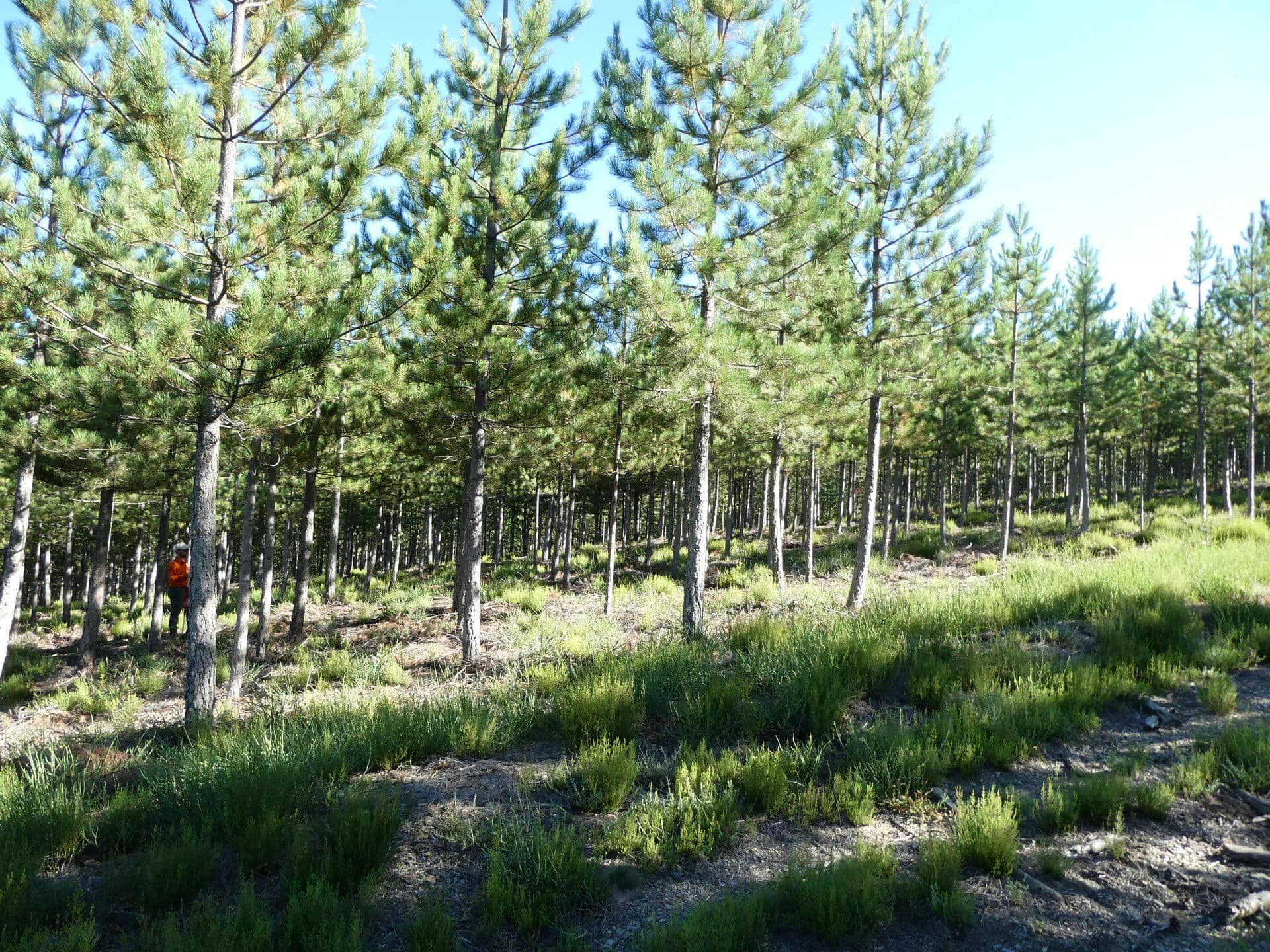
In the summer of 2024, LiDAR data were collected in young pine plantations in the Ourense province in northwest Spain using handheld mobile scanners (HMLS) and terrestrial laser scanners (TLS). In the field, 20 trees were measured, successively felled, dried and weighed.
The STSM/virtual mobility we propose represents the preliminary step in developing models for tree above-ground biomass (AGB) estimation based on HMLS and TLS-derived parameters and for comparing the LiDAR systems’ performance.
The steps that should be carried out during the STSM/VM can be summarised as follows: co-registering point clouds; identifying and extracting the weighted trees in the point clouds; calculating quantitative structure models (QSM) and extracting metrics to quantify the AGB, both in the QSM and the point cloud (e.g., crown diameter, crown area, tree height, DBH, diameters, volume from QSM, etc). Any subsequent steps will establish AGB equations using the extracted parameters as independent variables and biomass calculated from field measurements as the dependent variable, and compare classical allometries with TLS and HMLS point-cloud-based allometries to compare the traditional with the LiDAR-based approach, and for the latter, analyse the variability introduced by the sensors.

Objectives in synthesis and the expected result
The objectives of the STSM/VM are the (i) development of models to estimate AGB from HMLS and TLS point clouds derived predictors, (ii) the comparison of the performance of AGB prediction models based on HMLS and TLS data, and (iii) the assessment of the model accuracy for the two LiDAR sensors.
As a result of the STSM/VM, a scientific paper will be submitted.
Background of the candidate
She/he should be familiar with LiDAR technology and must have experience with dedicated LiDAR data processing packages (R or Python) and software (e.g., LAStools, CloudCompare and its plugins such as 3DFin, CompuTrees). Additionally, the candidate should be motivated to invest time beyond the STSM/VM to achieve publication within 10-12 months of the visit.

STSM host and location
The STSM will take place at the Institute of BioEconomy of the National Research Council of Italy, located in San Michele all’Adige, in northeast Italy (via Biasi, 75, 38057, San Michele all’Adige, TN), under the supervision of Chiara Torresan (chiara.torresan@cnr.it). In addition to Chiara Torresan, the study involves the effort and collaboration of María Menéndez (ICIFOR, INIA-CSIC, Spain), Fabian Fassnacht (FU Berlin, Germany), Carlo Cabo (University of Oviedo, Spain), and Juan Picos (University of Vigo, Spain).
In case of a VM, the candidate will carry out the activities in his/her place, and regular online meetings will be planned to discuss points and check the progress of tasks.
Expected duration and period
The STSM can start any time from today and end on 22 August 2025.
The VM can start any time from today and end at the end of September 2025.
In any case, to receive funding, a report must be submitted by the end of September.
Estimation of the expenses
3000-3500 €
How to apply?
- Chiara Torresan | chiara.torresan@cnr.it
- 3DForEcoTech | 3dforecotech@gmail.com